GIS: Saving Time and Costs With Real-World Data
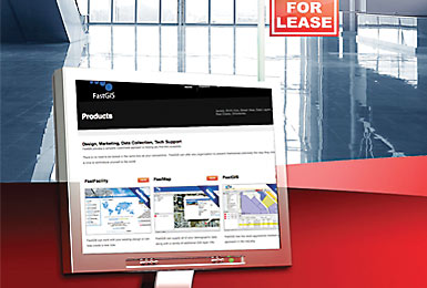
Site and facility planners are using Geographic Information Systems (GIS) technology to locate, analyze, and display site-specific demographics in readily accessible and easy-to-use formats.
June/July 10

"The key word to GIS technology is geography," agrees Caitlin Dempsey, editor of GIS Lounge (gislounge.com). "This means that the data, or at least some portion of the data is spatial, or in other words, data that is referenced to locations on the earth." Dempsey defines GIS as a "technological field that incorporates geographical features with tabular data, known as attribute data, in order to map, analyze, and assess real-world problems."
GIS is a decision-making tool that turns site selection data into meaningful information. "Data and information are not the same," explains Spraker. "Zip code data shows the number of people who live in that area. Meaningful information shows how zip codes tie into cold to hot population areas."
Filling Your Data Bucket
The use of Google maps has been prevalent among planners and site selection professionals to locate roads, water features, and political boundaries.
"Google offers good reference data, but it provides a small percentage of the local data that is needed by economic developers," notes Spraker. "Google is part of the solution; however, with GIS you can fill your data bucket with as much local environmental data as you can."
GIS applications provide a comprehensive view of a particular region. These applications or tools include:
• Unlimited data layers
• Bird's eye and street views
• Multiple database searches
• Available real estate integration
• Select map features
• Demographics
• Buffering
• Report generation
• Zoom
• Measurement
• Identity
• Customized inline help
• Printing
GIS Layering
An unlimited amount of data can be added to a location's GIS website to customize its region and its representative organizations. With specific site location details integrated into the GIS database that are unique to the region, site seekers can access up-to-date facts about zoning, schools, real estate, pub lic transportation, parcels, and infrastructure projects.
GIS layers, sometimes referred to as themes or categories, feature a map and the data behind it. Layers can show comparable properties, parcel boundaries, political boundaries, landmarks, facilities, transportation, and environmental features such as wetlands, floodplains, and agricultural areas.
"Layers help you put data sets together to get a close-up picture," Spraker says. "Using layers, you can examine an 800-acre parcel and know its zoning or if it's near an airport. You also might discover that three-fourths of that parcel is covered by a lake."
Saving Time and Money
GIS software saves time, reduces costs, and improves the quality of information needed to make decisions.
"The cost savings is not just on the economic development side," notes Spraker. "GIS usage saves time and costs on the business end as well by providing real-world data under one roof. Site seekers can take a virtual tour without ever leaving the office."
Site-selection analysis using GIS enables users to make decisions in a fraction of the time it takes to acquire data manually.
"Without GIS, it can takes weeks to compile data," says Spraker. "It's crazy to do that when you can answer site-selection questions in hours using GIS."
Project Announcements
Apex Plastics Opens Expanded Production Plant In Brookfield, Missouri
09/22/2014
Japan-Based Bridgestone Rubber-BSA Opens Biorubber Process Research Center In Mesa, Arizona
09/22/2014
SpencerARL Expands Its Plattsburgh, New York, Manufacturing Facility
09/22/2014
Hill International, Inc. Relocates Corporate Headquarters To Philadelphia, Pennsylvania
09/22/2014
Prysmian Group Plans $8.2 Million Expansion At Abbeville County, South Carolina, Manufacturing Center
09/22/2014
Japan-Based Kowa Kentucky Plans $8.3 Million Manufacturing Facility In Corbin, Kentucky
09/22/2014
Most Read
-
Run a Job Task Analysis
Q4 2024
-
The Location Economics of Advanced Nuclear
Q1 2025
-
39th Annual Corporate & 21st Annual Consultants Surveys: What Business Leaders and Consultants Are Saying About Site Selection
Q1 2025
-
NEW NIMBYism: A Threat to The U.S. Economy
Q4 2024
-
Power, Policy, and Site Selection in 2025
Q1 2025
-
Why Workforce Readiness Can’t Wait
Q1 2025
-
Designing Beyond the Assembly Line
Q1 2025